Two updates to Courtready’s mapping tools: the Ontario Judicial Regions Map now identifies your three nearest courthouses, and a new OLRB Geographic Areas Map replaces the government’s PDF with an address lookup.
Ontario Judicial Regions Map: nearest courthouse lookup.
The Ontario Judicial Regions Map now does more than identify your judicial region. Enter any Ontario address and the tool returns your region, your three nearest Superior Court courthouses within that region, and the distance to each one.
Each courthouse result includes a direct link to Google Maps directions and the courthouse website. Tap any courthouse card to see its pin on the map. The tool covers all 50+ Superior Court locations across Ontario’s eight judicial regions.
The upgrade matters for litigants choosing where to file. Rule 13.1.01 of the Rules of Civil Procedure sets the place of commencement for Superior Court matters, and the Small Claims Court rules require filing in the territorial division closest to where the defendant lives or carries on business. Knowing which courthouses are nearest, and how far apart they are, helps litigants make that decision before they file.
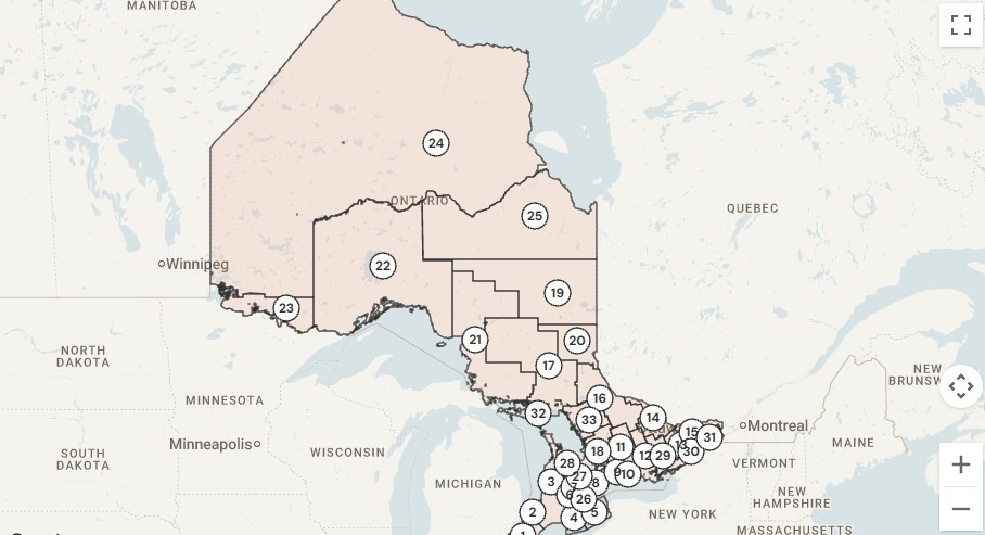
New tool: OLRB Geographic Areas Map.
The OLRB Geographic Areas Map is a new interactive tool that shows the 33 geographic areas used by the Ontario Labour Relations Board in construction industry certification cases.
Until now, the only reference available was a PDF published by the OLRB. The PDF shows area boundaries on a static map with no way to look up a specific address. Courtready’s version lets you enter any Ontario address and instantly identifies which of the 33 geographic areas covers it.
Try the OLRB Geographic Areas Map
Both tools are free and available now.